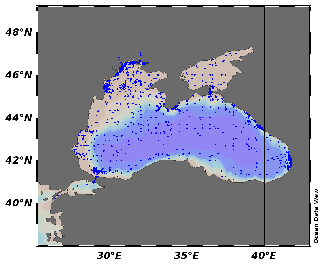
Black Sea - Contaminants aggregated datasets 1974/2017 v2018
Dataset extent
Map data © OpenStreetMap contributors
Tiles by MapBox
Tags
Data and Resources
To access the resources you must log in
-
Data Access and Citation
Data Access and Citation
The resource: 'Data Access and Citation' is not accessible as guest user. You must login to access it! -
Direct DownloadZIP
Direct Download
The resource: 'Direct Download' is not accessible as guest user. You must login to access it!
Geonetwork Links
Additional Info
| Field | Value |
|---|---|
| access_constraints | ["no limitations"] |
| bbox-east-long | 41.7762 |
| bbox-north-lat | 47.05833 |
| bbox-south-lat | 40.21667 |
| bbox-west-long | 26.45 |
| contact-email | [email protected] |
| coupled-resource | [] |
| dataset-reference-date | [{"type": "creation", "value": ""}] |
| graphic-preview-description | Water profiles |
| graphic-preview-file |  |
| GUID | d352642b-e188-43d5-b7f7-df4a103badb0 |
| licence | [] |
| metadata-date | 2019-05-07T09:46:46 |
| metadata-language | eng |
| point_of_contact 1 | [email protected] |
| point_of_contact 10 | [email protected] |
| point_of_contact 11 | [email protected] |
| point_of_contact 12 | [email protected], [email protected] |
| point_of_contact 15 | [email protected] |
| point_of_contact 16 | [email protected] |
| point_of_contact 17 | [email protected] |
| point_of_contact 2 | [email protected] |
| point_of_contact 4 | [email protected] |
| point_of_contact 6 | [email protected] |
| point_of_contact 7 | [email protected] |
| point_of_contact 9 | [email protected] |
| resource-type | series |
| responsible-party | [{"name": "Ukrainian scientific center of Ecology of Sea (UkrSCES)", "roles": ["originator"]}, {"name": "State Oceanographic Institute (SOI)", "roles": ["originator"]}, {"name": "Odessa Branch of SOI (State Oceanographic Institute)", "roles": ["originator"]}, {"name": "Scientific - Research Firm \"GAMMA\"", "roles": ["originator"]}, {"name": "North-Caucasus Regional Administration of Hydrometeorology of Roshydromet", "roles": ["originator"]}, {"name": "Ukrainian Hydrometeorological Institute - Marine Branch", "roles": ["originator"]}, {"name": "Institute of Oceanology, Bulgarian Academy of Sciences (IO-BAS)", "roles": ["originator"]}, {"name": "Istanbul University, Institute of Marine Science and Management", "roles": ["originator"]}, {"name": "Bulgarian National Oceanographic Data Centre(BGODC), Institute of Oceanology", "roles": ["originator"]}, {"name": "Institute of Marine Sciences, Middle East Technical University", "roles": ["originator"]}, {"name": "Georgian Institute of Water Management of Georgian Technical University", "roles": ["originator"]}, {"name": "Specialized Center for Hydrometeorology and Monitoring of Environment of Black and Azov Seas (SC HME BAS)", "roles": ["originator"]}, {"name": "P.P.Shirshov Institute of Oceanology, RAS", "roles": ["originator"]}, {"name": "National Institute for Marine Research and Development \"Grigore Antipa\"", "roles": ["author"]}, {"name": "State Oceanographic Institute, Sebastopol Branch (SB SOI)", "roles": ["originator"]}, {"name": "Iv.Javakhishvili Tbilisi State University, Centre of Relations with UNESCO Oceanological Research Centre and GeoDNA (UNESCO)", "roles": ["originator"]}, {"name": "Tuapse Hydrometeorological Bureau, North-Caucasus Centre", "roles": ["originator"]}] |
| spatial | {"type": "Polygon", "coordinates": [[[26.45, 40.21667], [41.7762, 40.21667], [41.7762, 47.05833], [26.45, 47.05833], [26.45, 40.21667]]]} |
| spatial-reference-system | WGS 84 (EPSG 4326) |
| spatial_harvester | true |
| system:type | Series |
| temporal-extent-begin | 1974-08-24 |
| temporal-extent-end | 2017-10-06 |
| topic_category | oceans, biota, environment |
Management Info
| Field | Value |
|---|---|
| Author | EMODnet Chemistry |
| Maintainer | iMarine Catalogue Manager |
| Last Updated | 25 July 2019, 12:01 (CEST) |
| Created | 25 July 2019, 12:01 (CEST) |
